The Proposed Development
The Site & Surrounding Area
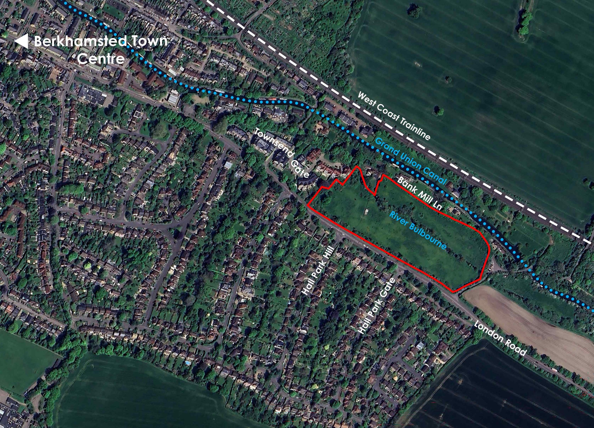
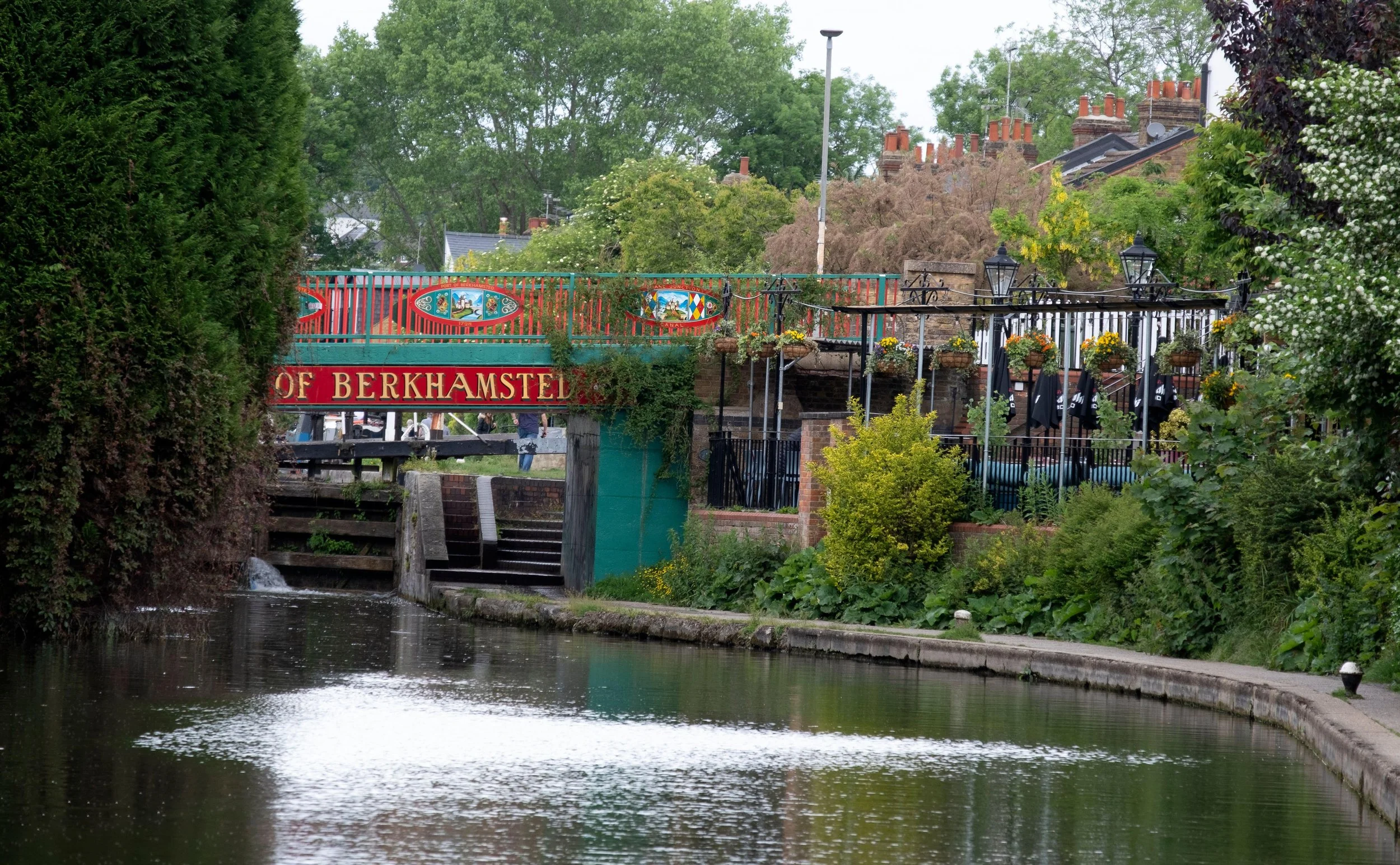
The site comprises 3.74 hectares of land located towards the south-eastern extents of the town. The site is bound by London Road to the south, Bullbeggars Lane to the east and Bank Mill Lane to the north, beyond which is the Grand Union Canal.
The proposed planning application area includes two undeveloped fields bisected by an existing watercourse which runs through the site from north-west to south-east. The site sits within a valley and slopes gently down towards the watercourse from London Road, before rising again towards Bank Mill Lane.
To the immediate northwest is the modern development at Townsend Gate, comprising a mix of multi-storey apartment buildings and houses. To the south, on the opposite side of London Road, lies additional residential development in the form of predominantly 2 and 2.5 storey houses. Those houses are situated on higher ground than the site, with levels continuing to rise the further south one proceeds along Hall Park, Hall Park Hill and Hall Park Gate.
The site is currently designated as Green Belt land, as is all undeveloped land around Berkhamsted. However, early discussions with Dacorum Borough Council have revealed that the site could be considered ‘Grey Belt.’ This means that subject to compliance with the ‘Golden Rules’, in accordance with national planning policy development on the site is not considered inappropriate.
The ‘Golden Rules’ are a set of key requirements for development on Green Belt land. This requires that developments must provide a certain level of affordable housing, improvements to local infrastructure (usually through financial contributions) and provide new or improved publicly accessible green spaces.
The site forms part of the modern extension to the Berkhamsted Conservation Area and therefore any development proposals will be carefully designed to respect the significance of this heritage asset – particularly in regard to the layout and form of buildings, preservation of green spaces and treatment of existing vegetative boundaries. The site does not fall within the Chiltern Hills National Landscape designation and is not covered by any local landscape designation.
The Site is sustainably located, with vehicular access off London Road. Four bus stops are located adjacent to the site along London Road, which provide regular services into the town centre and to surrounding towns and villages. Footways also provide links into Berkhamsted Town Centre with the High Street approximately 700m to 750m from the site.
There are also a range of services and facilities within Berkhamsted which are located within the vicinity of the site, which include a Waitrose, Tesco Express, and a range of convenience and local high street stores, nurseries, primary and secondary schools and a sixth form, leisure centre and gymnasiums, a golf club, a cricket club, a hospice, doctor’s surgeries, a dentists, public houses, restaurants with takeaway facilities and a range of other services and facilities.
Development Proposals
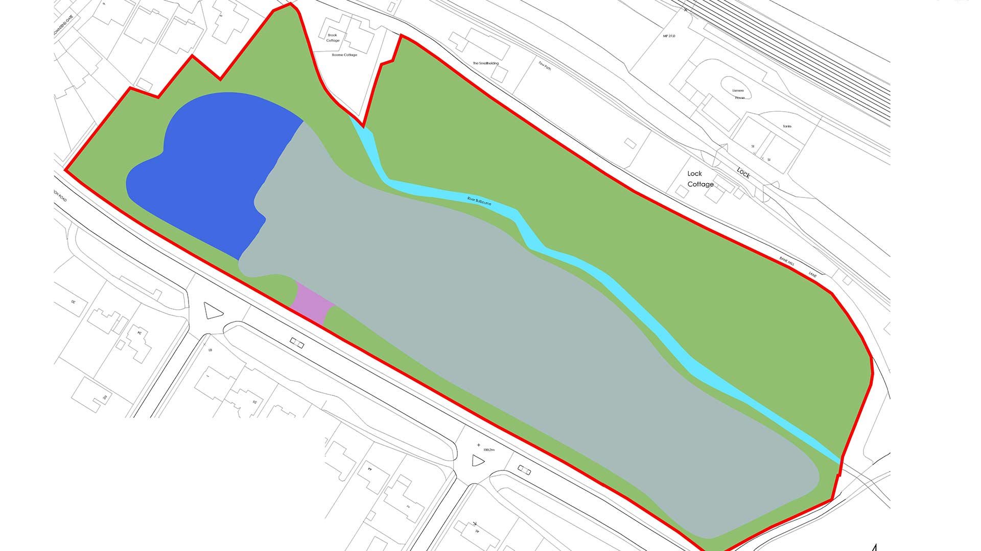
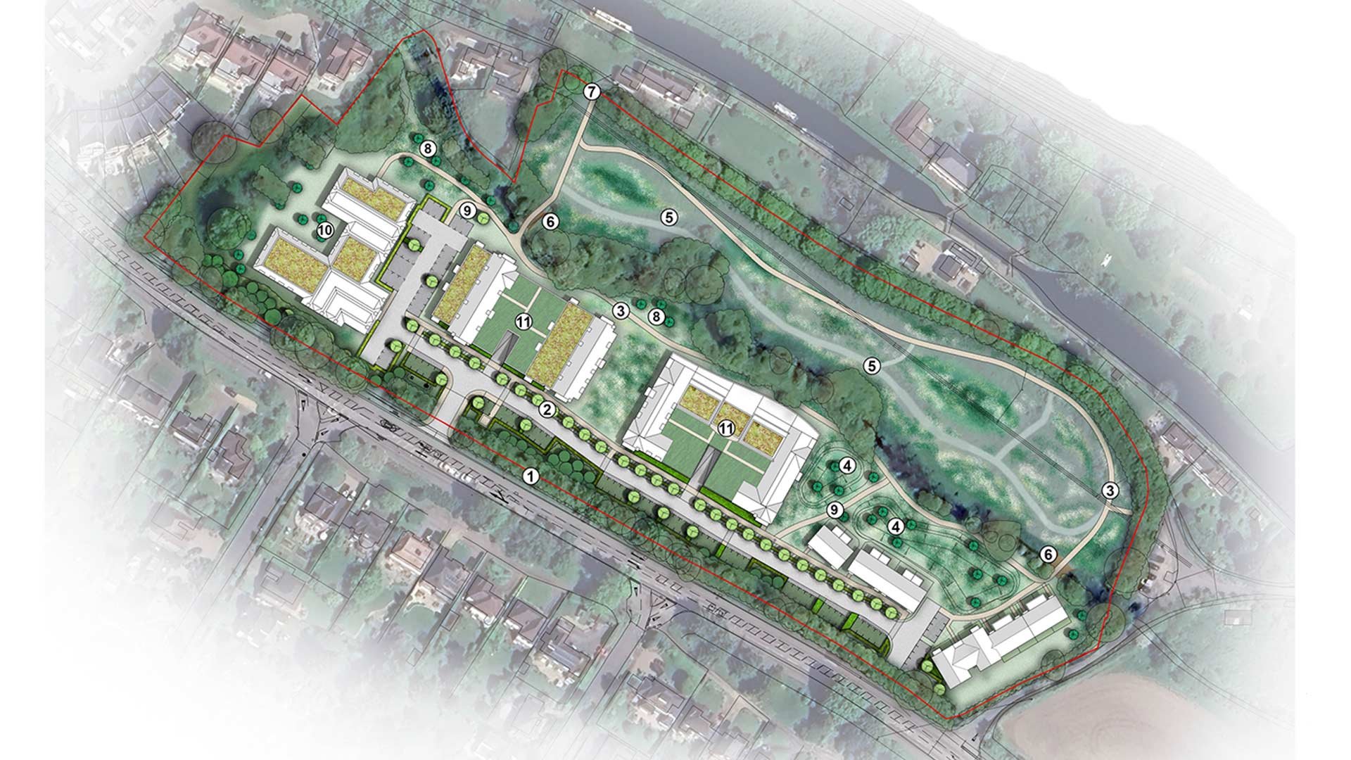
Key:
🟥 Site Boundary
◻️Development Area
🟦Care home land
🟪Primary Site Access
🟩Green Infrastructure
Land Use Parameter Plan (scale 1:500)
The proposed built form will be limited to the part of the site which lies to the south of the existing watercourse. A single point of access into the site is proposed off London Road. The development pattern seeks to reflect the existing arrangement south of London Road with buildings served off an internal spine road. The new care home is proposed to be located in the north-western part of the site, closest to Townsend Gate with the retirement homes located within the central and south-eastern parts of the site.
The parcel of land to the north of the existing watercourse will remain undeveloped and delivered as publicly accessible open space. This will provide green infrastructure, biodiversity enhancement and opportunities for recreation including onward connectivity to nearby walking leisure routes.
Retirement Homes

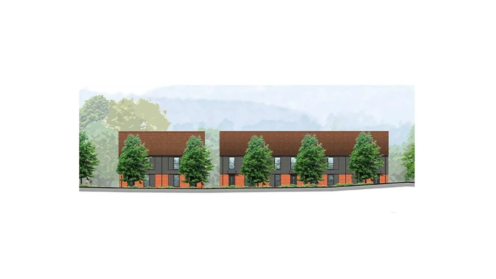
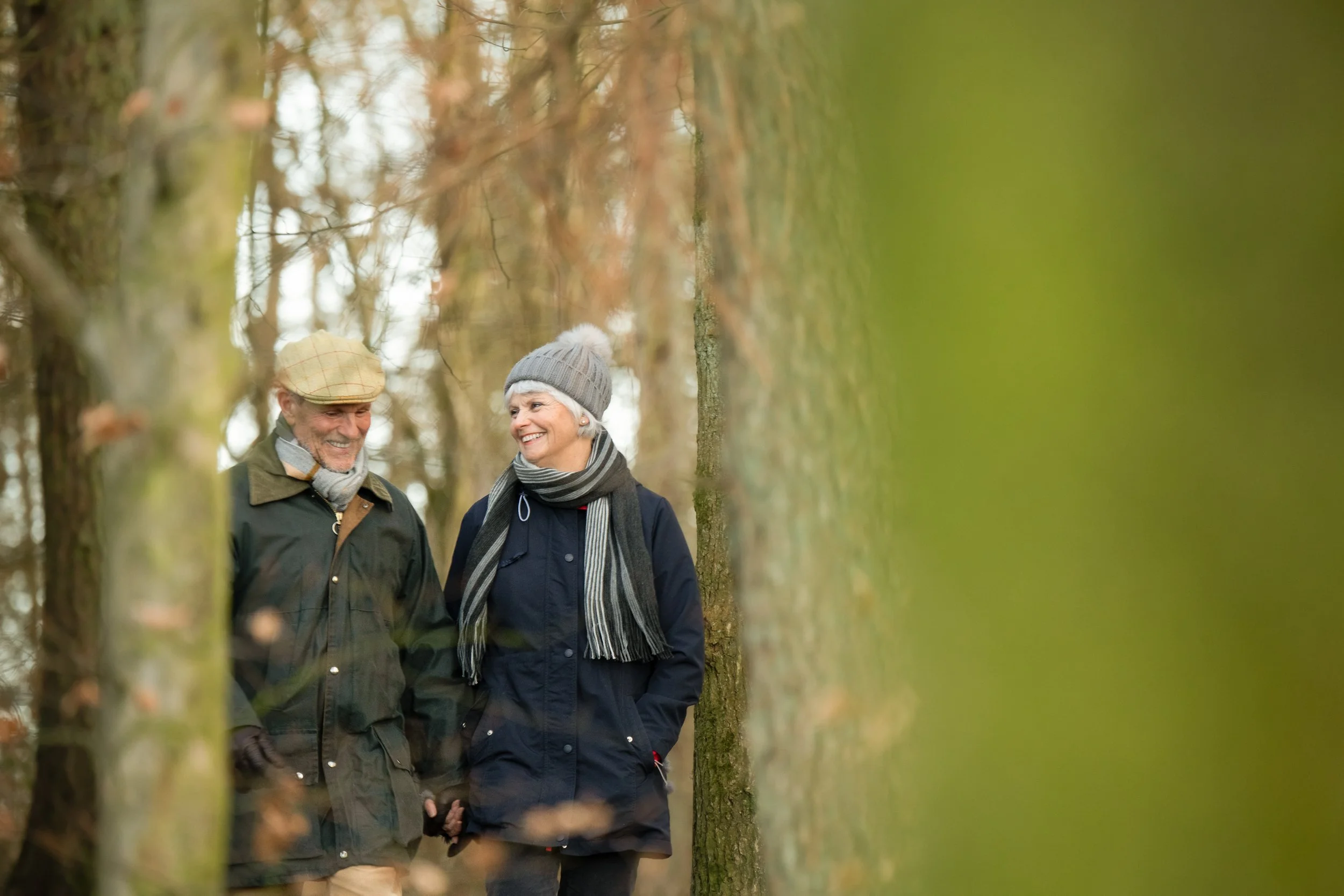
A key part of the scheme is the development of up to 90 no. age-restricted retirement homes for those aged 55 years and over. 50% of these properties will be provided as affordable tenure homes. The accommodation provided will include shared communal facilities including a resident’s lounge, guest suite and an on-site estate manager to provide older people with an element of support to live independently.
The dwellings will comprise of a mix of 1 and 2-bedroom apartments and cottages. The proposed scale and form of development, including storey heights, responds to the existing topography of the site and will be in keeping with existing development in the area. The proposed buildings will therefore vary in scale from 2-3 storeys fronting London Road, with 4-storey elements on elevations facing north onto the watercourse where site levels are lower.
Care Home Development

The proposed 75-bed care home will be located within the north-western part of the site and will be 3-storeys in height. In terms of materials, this will reflect that of the surrounding residential development. The purpose-built accommodation will contribute towards the identified needs for care home bedspaces and improve the quality of supply including the provision of en-suite bedrooms and delivery of dementia-friendly design.
Landscape, Biodiversity, Open Space and Recreation
The proposals include new native tree planting and extensive landscaping within the site and along its boundaries to help assimilate the new buildings within the surrounding landscape. In addition, generous amenity areas are proposed for the residents of the scheme, in particular the communal landscaped areas in between the apartment blocks.
An area of new public open space is proposed to be created in the part of the site to the north of the watercourse. This will include a walking route along with opportunities to sit, in addition to onward connections to nearby walking and leisure routes. The intention is to create an attractive and natural backdrop to the proposed development and opportunities for recreation for new and existing residents to enjoy.
On-site and off-site ecological enhancement measures will ensure the scheme will deliver a minimum 10% net gain in biodiversity.
London Road Frontage: The existing hedgerow and trees will be reinforced by native woodland planting to establish a long-term native treebelt.
Treelined Footpath: A treelined footpath is proposed alongside the new access road. This provides structural landscaping set back from London Road for visual integration of the Proposed Development.
Riverside Walk: A new riverside walk will be created via a hardstanding pedestrian footpath, running through new wet meadow and riparian tree planting areas.
SuDS/Wet Woodland Planting: Above-ground basins form part of the surface water drainage strategy. The basins will include suitable wet environment planting for additional ecological benefits.
Mown Footpaths: Mown paths will be provided through areas of meadow and riparian planting. The proposed SANG (Suitable Alternative Natural Greenspace) will be enhanced with native planting.
Footbridges: These will provide direct access across the River Bulbourne between the Proposed Development and SANG/Public Open Space.
Potential access provided onto Bank Mill Lane: This will use an existing field gate and will be via a hardstanding footpath.
Specimen native tree planting within areas of meadow.
Secondary footpaths: These will provide residents direct access to the Riverside Walk and feature a naturalistic planting palette.
Formal Courtyards: These will provide both communal and private open spaces/gardens for residents of the care home.
Green Roofs: Parts of the buildings with flat roof elements will comprise 'green roofs' to include sedum planting or other appropriate species.
Flood Risk and Drainage
The part of the site where built form is proposed is located within Flood Risk Zone 1, the lowest probability of flooding. It is proposed that surface water will be discharged via Sustainable Urban Drainage Systems (SuDS) in accordance with the drainage hierarchy.
Access
Vehicular access to the site is proposed from London Road. New pedestrian access points are also proposed to connect the site to Bank Mill Lane and Bullbeggars Lane. Car parking (including visitor parking) will be provided in line with Dacorum Borough Council’s Car Parking Standards. Secure cycle parking will also be provided for residents.
‘The parking provision will be facilitated through a combination of undercroft parking and surface parking.
Pedestrian walking routes through the site and open space to the north have also been included to create a safe and pleasant environment and enhance connections to existing public footpaths within the surrounding area.
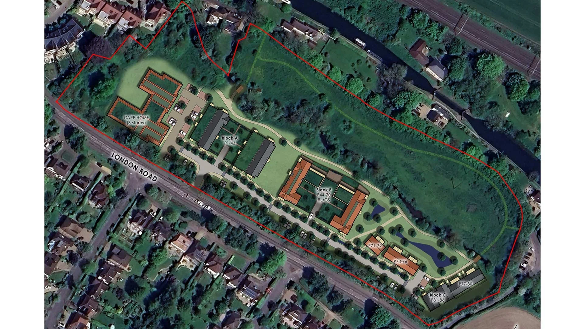
Illustrative site layout